
🎥 Featured Video: Hidden Beaches & Water Spots in Austin
Discover where locals cool off with this behind-the-scenes tour of Austin's secret beaches.
📊 Real-Time Lake and Creek Water Levels
- Lake Travis (Live Webcam)
- Barton Creek Greenbelt (aka Hill of Life, Sculpture Falls, Twin Falls, Gus Fruh, The Flats, Campbell's Hole, Barton Springs)
- Walter E. Long Metropolitan Park (Map)
- Loop 360
- Lake Pflugerville
- Lake Bastrop (aka Colorado River Basin)
🏖️ Top Austin Beaches and Swim Spots
- Bob Wentz Park at Windy Point – Best for clear water and diving.
- Emma Long Park – Shaded beach area with camping nearby.
- Pace Bend Park – Cliff jumping and calm inlets.
- Secret Barton Creek Access Trails – Great for hiking and shallow swimming.
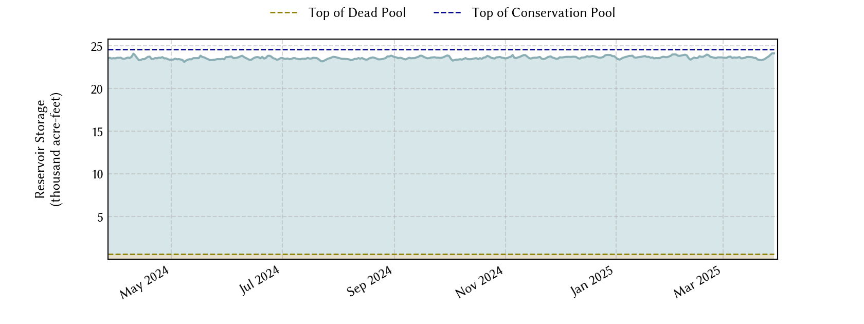
Austin-Area Water Storage
Lake and reservoir conditions can affect recreation, waterfront activity, and local conversation around Central Texas water resources. This chart is provided for general reference, not as a forecast or property-specific analysis.